
Drones Transforming Modern Farming
Table of Contents
- The Aerial Revolution: Agricultural Drones as the New Standard
- Multispectral Sensing and the Science of Plant Health
- Precision Spraying: Reducing Chemical Load through Targeted Delivery
- The Role of Swarm Intelligence in Large-Scale Operations
- Automated Irrigation Management and Water Conservation
- Livestock Monitoring and Management from the Sky
- Mapping and Topographical Analysis for Better Land Use
- Challenges to Adoption: Regulation, Battery Life, and Data Security
- The Economic Impact: ROI and the Future of Small-Scale Farming
- Conclusion: Toward a Fully Autonomous Agricultural Ecosystem
The Aerial Revolution: Agricultural Drones as the New Standard
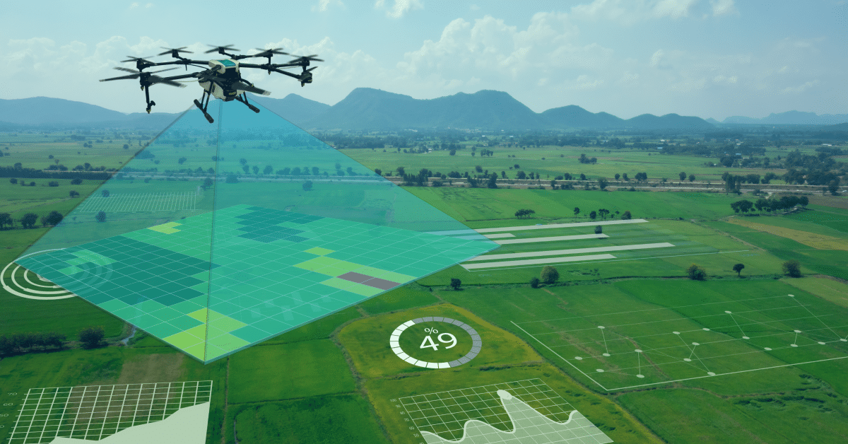
In the final months of 2025, the sight of a drone hovering over a field has transitioned from a high-tech novelty to a fundamental component of the global agricultural landscape. This aerial revolution is being driven by the urgent need for “Precision Agriculture,” a farming management concept based on observing, measuring, and responding to inter-field and intra-field variability in crops. As global populations continue to rise and climate change makes weather patterns increasingly unpredictable, farmers are turning to Unmanned Aerial Vehicles (UAVs) to maximize yields while minimizing the use of resources like water, fertilizers, and pesticides. The modern agricultural drone is far more than a flying camera; it is a sophisticated data-gathering and delivery platform that integrates advanced robotics, artificial intelligence, and specialized sensors to provide a “God’s-eye view” of the farm that was previously impossible to achieve without expensive satellite imagery or manned aircraft.
The speed of adoption is particularly notable in 2025 as the hardware has become more rugged and the software more intuitive. Even for farmers without a background in technology, the current generation of drones offers “plug-and-play” simplicity, allowing them to automate flight paths and data collection with a few taps on a tablet. This accessibility is leveling the playing field, enabling small and medium-sized farms to compete with large industrial operations by optimizing their inputs and reducing manual labor costs. As we look toward 2026, drones are not just helping farmers work harder; they are helping them work smarter, turning raw data into actionable insights that can be the difference between a record harvest and a devastating loss. The transformation is comprehensive, touching every stage of the growing cycle from soil analysis and planting to harvest monitoring and crop protection.
Multispectral Sensing and the Science of Plant Health
One of the most powerful ways drones are transforming farming is through the use of multispectral and hyperspectral sensors. While the human eye can only see the visible light spectrum, these advanced sensors can capture infrared and near-infrared light reflected by plants. This data is used to calculate indices such as the Normalized Difference Vegetation Index (NDVI), which provides a direct measurement of plant health and photosynthetic activity. In 2025, this technology allows farmers to detect “hidden” stressors—such as early-stage nutrient deficiencies, water stress, or pest infestations—days or even weeks before they become visible to a human scout walking the fields. By identifying these issues early, farmers can intervene precisely where needed, preventing a localized problem from becoming a field-wide disaster.
The integration of AI with this multispectral data has reached a new level of maturity. Modern agricultural software can now automatically analyze drone imagery to create “prescription maps” that are uploaded directly to smart tractors and irrigation systems. This means that if a drone identifies a specific nitrogen deficiency in a five-acre corner of a thousand-acre field, the fertilizer spreader will automatically increase the dose in only that specific area. This level of granularity not only improves crop health and yield but also significantly reduces the environmental impact of farming by preventing the over-application of chemicals that could otherwise leach into local water systems. The drone has effectively become the “diagnostic tool” of the modern agronomist, providing a level of precision that is fundamentally changing the science of crop management.
Precision Spraying: Reducing Chemical Load through Targeted Delivery
Drone technology is also revolutionizing the physical application of crop protection products through precision spraying. Traditional methods of spraying—whether by tractor-mounted booms or piloted crop dusters—are often inefficient, leading to chemical drift and excessive application. In contrast, spraying drones equipped with ultra-low volume (ULV) nozzles and sophisticated flight controllers can fly just meters above the crop canopy, delivering a targeted mist that coats the plants evenly while minimizing waste. In 2025, heavy-lift drones capable of carrying 40 to 70 liters of liquid have become commonplace, allowing them to cover large areas quickly while navigating difficult terrain that would be inaccessible to ground-based machinery.
The real power of drone spraying lies in its ability to perform “spot treatments.” Instead of spraying an entire 100-hectare field to treat a small outbreak of fungal disease, a farmer can use a drone to target only the affected clusters identified during a previous scouting flight. This approach can reduce chemical usage by up to 60 percent, representing a massive cost saving for the farmer and a major win for biodiversity. Furthermore, drones eliminate the soil compaction issues caused by heavy tractors moving through wet fields and protect human workers from exposure to potentially harmful chemicals. As we move into 2026, the use of drones for the variable-rate application of herbicides, fungicides, and liquid fertilizers is set to become the standard practice for high-value crops and sustainable farming initiatives worldwide.
The Role of Swarm Intelligence in Large-Scale Operations
A significant trend for late 2025 is the move from single-drone operations to “drone swarms.” Swarm intelligence allows a single operator to manage a fleet of five, ten, or even twenty drones that work in perfect coordination to complete a task. For massive agricultural estates in regions like Brazil, the United States, and Australia, swarms are the only way to scale the benefits of drone technology to cover thousands of acres in a single day. These swarms use mesh networking to communicate with each other, ensuring they don’t collide and that they divide the workload efficiently, with some drones returning to automated docking stations for battery swaps while others continue the mission.
This “collective” approach to aerial farming is particularly effective for time-sensitive tasks, such as responding to a sudden pest outbreak or capturing high-resolution imagery during a narrow window of ideal weather. Swarms also provide a level of redundancy; if one drone in the fleet experiences a mechanical failure, the others can automatically adjust their flight paths to cover the missing area. The software driving these swarms is powered by edge computing, allowing the drones to process data and make decisions in real-time without needing a constant connection to a central server. As this technology becomes more refined, the “fleet manager” role will become a key position on the modern farm, overseeing a robotic workforce that operates with a level of speed and precision that was previously unimaginable.
Automated Irrigation Management and Water Conservation
Water is perhaps the most precious resource in agriculture, and drones are playing a critical role in optimizing its use through automated irrigation management. In 2025, drones equipped with thermal sensors are being used to map the “temperature signature” of a field, which is a highly accurate indicator of soil moisture and plant transpiration rates. Areas that appear warmer in the thermal scan are typically drier, allowing farmers to identify leaks in irrigation pipes or “dry spots” where the water is not reaching the crop. This allows for the creation of precise irrigation schedules that deliver water only when and where it is needed, significantly reducing overall consumption.
This data is increasingly being integrated into “Smart Irrigation” systems. When a drone detects water stress, it can trigger a command to the automated pivot or drip irrigation system to adjust the flow rate for that specific zone. In regions facing severe drought and water restrictions, this technology is a lifeline that allows farmers to maintain productivity with a fraction of the traditional water requirements. Beyond just identifying dry spots, drones are also being used to monitor the quality of irrigation water, detecting signs of algae blooms or high salinity that could harm the crops. By turning water management into a data-driven process, drones are helping to build a more resilient agricultural sector that can thrive even as water resources become increasingly scarce.
Livestock Monitoring and Management from the Sky
While much of the focus is on crops, drones are also transforming the way livestock are managed, particularly in the extensive ranching operations of North and South America. In 2025, drones equipped with high-definition zoom lenses and thermal cameras are used to perform “remote mustering” and health checks. Instead of spending hours or days on horseback or in an ATV to find a missing cow, a rancher can launch a drone that uses AI-powered object detection to locate the animal in minutes, even in thick brush or rugged terrain. Thermal sensors allow the drone to identify sick animals by detecting elevated body temperatures, enabling early intervention before a disease can spread through the herd.
Drones are also being used to monitor the quality of grazing lands and the levels in remote water troughs, reducing the need for frequent and expensive manual inspections. Some innovative ranchers are even using drones equipped with speakers that emit specific frequencies or recorded sounds to move cattle from one pasture to another, a process known as “virtual herding.” This reduces the stress on the animals and prevents the soil erosion often caused by traditional herding methods. As the technology matures, we are seeing the development of drones that can read individual electronic ear tags from a distance, allowing for automated inventory management and traceability. For the modern rancher, the drone is the ultimate tool for maintaining the health and security of their livestock across vast, difficult landscapes.
Mapping and Topographical Analysis for Better Land Use
Accurate land mapping is the foundation of any successful farming operation, and drones have made high-quality topographical data more accessible than ever before. In 2025, farmers use drones equipped with LiDAR (Light Detection and Ranging) to create highly detailed 3D models of their land, capturing every slope, drainage pattern, and elevation change with centimeter-level accuracy. This data is invaluable for planning new drainage systems, preventing soil erosion, and optimizing the placement of roads and buildings. By understanding the “shape” of their land in three dimensions, farmers can make more informed decisions about which crops to plant in specific areas to take advantage of natural moisture levels and sunlight exposure.
This topographical analysis is also essential for “Variable Rate Seeding.” By combining soil maps with topographical data, drones help farmers determine the optimal seed density for different parts of a field. For example, seeds can be planted more densely in high-yield areas with good drainage while being thinned out in lower-quality zones, ensuring that every seed has the best possible chance of reaching maturity. This level of planning was previously only available to the largest corporate farms with access to specialized survey crews. Today, any farmer with a mid-range drone can perform their own topographical surveys as often as they like, ensuring that their land-use strategy is always based on the most current and accurate data available.
Challenges to Adoption: Regulation, Battery Life, and Data Security
Despite the rapid progress, the transformation of farming through drones faces several significant hurdles that the industry is working to address as we head into 2026. The most prominent challenge is the complex and often restrictive regulatory environment. In many countries, “Beyond Visual Line of Sight” (BVLOS) operations—which are essential for covering large farms—are still heavily regulated or require special permits that can be difficult to obtain. Governments are currently working on “U-Space” and other traffic management systems to allow agricultural drones to share the airspace safely with manned aircraft, but the legal framework in many regions is still catching up to the technology.
Technical limitations also remain, particularly regarding battery life and data management. Most heavy-lift spraying drones can only fly for 10 to 20 minutes before needing a battery swap, which can create a bottleneck in high-intensity operations. While manufacturers are exploring hydrogen fuel cells and rapid-charging technologies, the energy density of batteries remains a limiting factor. Furthermore, the massive amount of data generated by a single drone flight—often gigabytes of high-resolution imagery—requires significant processing power and high-speed internet to be truly useful. For farmers in remote areas with poor connectivity, managing this “data deluge” is a major challenge. Finally, as farms become more digital, data security is a growing concern, with farmers needing assurance that their proprietary crop data and topographical maps are protected from unauthorized access or cyberattacks.
The Economic Impact: ROI and the Future of Small-Scale Farming
The economic argument for drones in agriculture is becoming overwhelmingly positive, with clear evidence of a strong Return on Investment (ROI) across various crop types. In 2025, studies show that the use of drones for precision scouting and targeted spraying can increase net profits by 5 to 15 percent by reducing input costs and increasing overall yields. For high-value crops like grapes, nuts, and berries, the ROI is even higher due to the extreme precision required for management. As the cost of the hardware continues to fall, the “payback period” for an agricultural drone system is now often less than a single growing season, making it a viable investment for almost any commercial farming operation.
Crucially, this technology is empowering the future of small-scale and family-owned farms. By providing access to high-end data and automation, drones allow smaller operations to achieve levels of efficiency that were previously the exclusive domain of giant agribusinesses. In many developing countries, “Drone-as-a-Service” (DaaS) providers are emerging, allowing smallholder farmers to hire a professional drone pilot for a day to map or spray their fields for a fraction of the cost of owning the equipment. This “service-based” model is democratizing precision agriculture, ensuring that the benefits of the aerial revolution are shared by farmers regardless of their size or location. As we move into 2026, the economic impact of drones will be measured not just in corporate profits, but in the increased resilience and sustainability of the global food supply chain.
Conclusion: Toward a Fully Autonomous Agricultural Ecosystem
As we look toward the future, the transformation of modern farming through drones is leading toward a fully autonomous agricultural ecosystem. In this vision of 2026 and beyond, the drone is no longer a standalone tool but an integrated part of a “farm operating system” where autonomous tractors, soil sensors, and aerial vehicles work together without human intervention. Drones will launch automatically from solar-powered docks at the first sign of a weather change or a pest detection, sharing their data with the irrigation system and the harvesting schedule to optimize every aspect of the farm in real-time. This move toward “Hands-Free Farming” represents the ultimate evolution of the agricultural industry, promising a future of abundance where food is grown with maximum efficiency and minimum environmental impact. While the technology will continue to advance, the core mission remains the same: using the power of flight and data to ensure that we can feed a growing world while protecting the planet for future generations. The era of the drone-powered farm has arrived, and it is reshaping the very foundation of human civilization.
References
Drones in Agriculture: Trends for 2025/26 (AgriFutures) |
The Evolution of Ag Drones Beyond 2025 (PFD) |
FAO Report: Drones and Global Food Security (FAO)